Thumbs Up or Down
0 liked this post
0 didn't like this post
Mist Mountain Hot Springs:
-approx 8km round trip to the springs
-Elevation gain: approx 490m (to the hot springs),
-Difficulty: moderate
-Time required: approx 2-3 hours
-quite easy if you know how to use a GPS, otherwise pretty tough.
-Trailhead GPS: 50.52318, -114.884079
-MAP TO GET YOU THERE
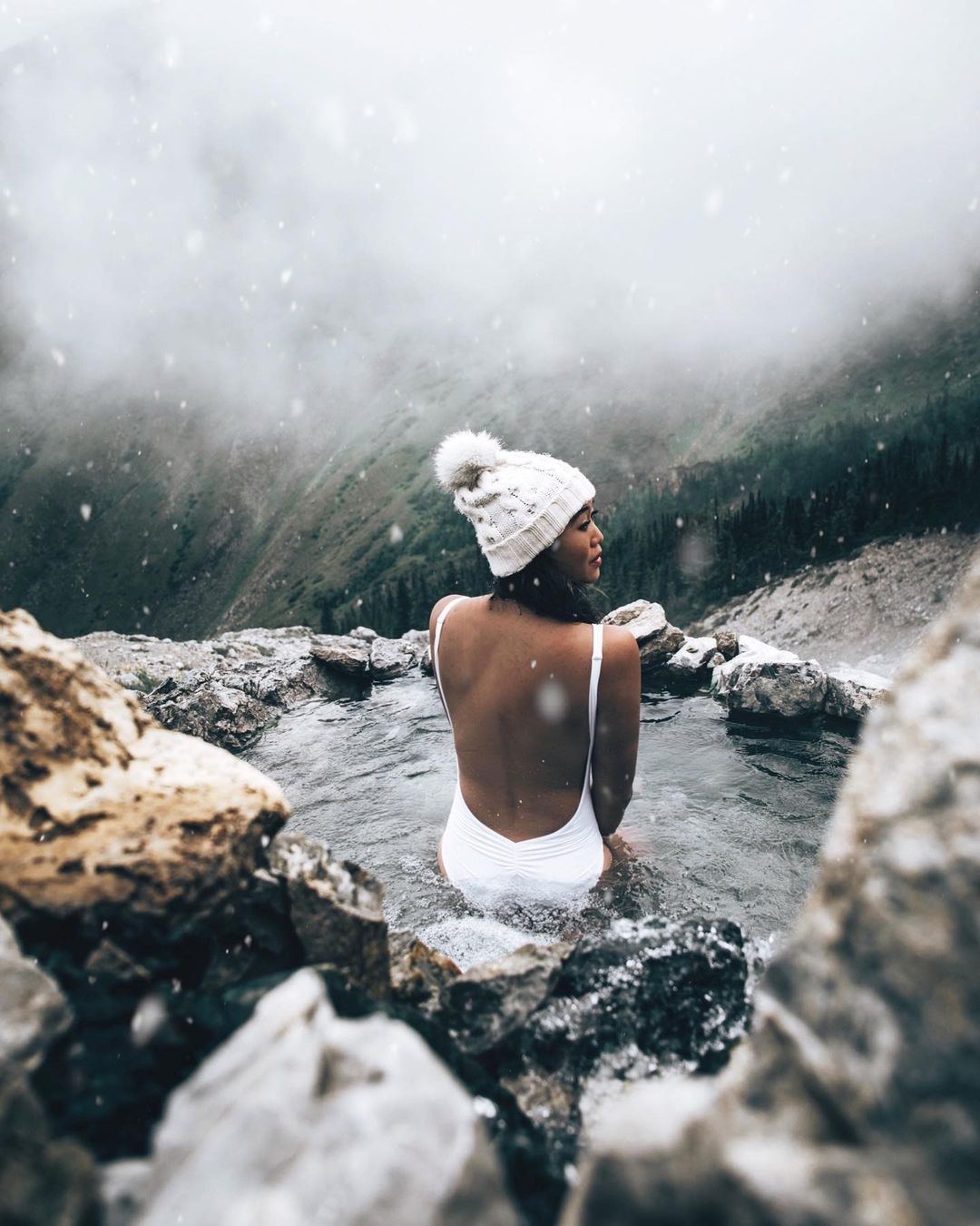
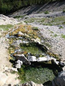
Hidden away in the middle of Kananaskis Provincial Park, Just over the BC / Alberta border, you’ll find two tiny hot pools with breathtaking mountain views. Not only are they beautiful, but they’re also the only Southern Albertan undeveloped Hot Spring that you can actually bathe in!
They have a similar vibe to Ram Creek Hot Springs but much smaller (There are two pools that can both fit two people at most) and take a lot more physical effort to get to. You have to hike halfway up a mountain to find Mist Mountain Hot Springs
with a bit of effort. Mist Mountain Hot Springs can be an incredible adventure. Here’s all you need to know about Mist Mountain Hot Springs.
To find the trailhead, head into Kananaskis along highway 40. Coming from Canmore, pass the “Pocaterra Ridge” trailhead and continue a little further. A green ribbon marks the trailhead, tied to a tree and should be easy to find, as there is a pullout with enough parking for a few dozen cars. 50.523181, -114.884079 If you reach the “Picklejar Lakes” trailhead, you’ve comegone too far.
Use the GPS coordinates above to find the exact starting point. It will be difficult to find without it; Simply park on the side of the road and look for the hole in the trees where the trail begins.
TIP: Enter your GPS coordinates before you enter the backcountry because Once you’re buried in the mountains, there’s no cell service. Mist Mountain Trailhead can also be found in Google Maps if you type it in.
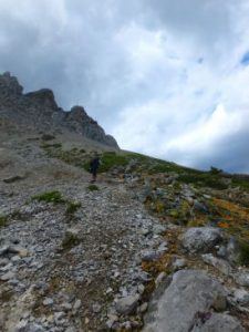
Once you’re out on the trail,, it’s well used and easy to follow
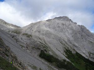
Follow the trail higher until you reach the grassy saddle/meadow. At this point, there is a fork in the road. Take a left and walk around the mountain, roughly maintaining the same elevation.
The hot springs should be obvious from a long way away because you can see the steam coming from them, or you can see the bright orange algae consumed rocks that stand out against the mountains.
Parts of Highway 40, which is the road you travel through Kananaskis and goes past the trailhead, are CLOSED between December and June, It’s best to visit during the summer months. You could visit during the other months, However, you’d have to cycle or hike 30 kilometres from the park’s entrance to get there.
Also, it probably wouldn’t be warm enough to bother visiting in the winter. There is also quite a big avalanche risk in winter. The path crosses a number of avalanche routes.
Kananaskis Provincial Park is a BIG TIME bear country. You will see more grizzlies in this area than anywhere else in the area. Don’t do this hike without ample bear spray, and ideally, bring a few friends.
If you love hot springs, you know it’s worth the little extra effort to track places like these down! If you Truly like hot springs, Not just the swimming pool style commercial springs you’ll find in Banff, Ainsworth, and Radium, then these will totally be worth adding to your bucket list!
Fetured photo and voideo by @wzylouisey Check out their blog Elite Jetsetter its loaded with adventures, and travel ideas from their journeys to over 35 different countries around the world.
[owm-weather id=”3543″/]
This error message is only visible to WordPress admins
Error: No posts found. No posts made to this hashtag within the last 24 hours. No posts made to this hashtag.
Views:
4,811 views