Thumbs Up or Down
0 liked this post
0 didn't like this post
61.942499, -127.181111
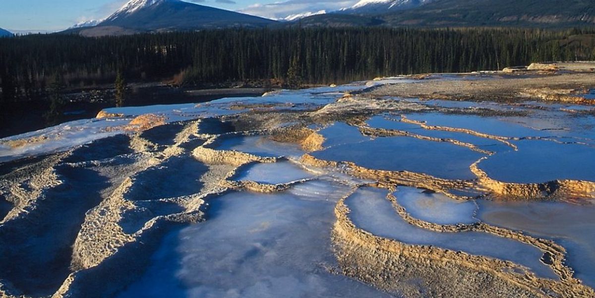
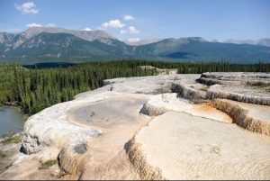
In the Northwest Territories, there is a naturally occuring hot spring. The springs are situated on a limestone plateau in the Nahanni National Park Reserve, near the South Nahanni River, and consist of two enormous travertine mounds. The valley of the South Nahanni River is one of the most stunning wilderness locations in North America, if not the entire world. This vast northern river flows through stunning mountains, deep gorges, and spectacular waterfalls. There are hundreds of caves around the river, as well as odd folklore, such as well-documented examples of mysterious gold prospector fatalities allegedly caused by bigfoot.
The South Mound has grown into an adjacent slope and is now only about half as tall as the North Mound. They are the world’s only tufa mounds known to be situated atop permafrost. The mounds are layered and multicoloured.
Rabbitkettle gets its name from the Dene word gahnhthah, which means “kettle.” Because of the unusual shapes of the basins in the area, English-speaking inhabitants dubbed it “Rabbitkettle.” The Dene treated the springs as a sacred site, leaving offerings such as tobacco to ensure good fortune.
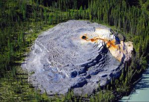
The springs’ water comes from a fissure in the limestone plateau, and the mechanics of piping pseudokarst suck hot water from roughly 2,000 metres (6,600 feet) below through the fault.
The water emerges at the top of the mound in a central pool and flows down via a terrace of surrounding basins. These pools’ travertine walls can be as tall as 30 cm (12 in) and come in a variety of colours ranging from grey to off-white. The dissolved minerals from the limestone, such as calcium carbonate, are abundant in the spring water. These minerals are formed on any surface where water runs, gradually coating it and building tufa formations called rimstone dams and gours. The older pools eventually fill up with deposited minerals, causing the water to overflow the margins and form new pools.
The pools were formed after the end of the last glacial period, some 10,000 years ago, when the continental ice caps retreated.
Travertine formations are uncommon in the far north, as the travertine is regularly broken by frost. The floods, as well as animals, do further harm in Rabbitkettle.
Many people used to swim in these rimstone ponds, leaving terrible scars on the mounds — tourist tracks. These delicate structures have been closely protected since the 1980s.
Geology and Geomorphology
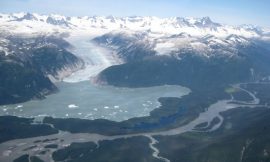
The Nahanni National Park Reserve is located in the cordilleran physiographic region’s northern part. Mountain ranges, undulating hills, towering plateaux, vast depressions, and incised river basins make up the park’s landscape, which is largely mountainous. The park’s elevations range from 180 metres above sea level (ASL) near the eastern border to 2640 metres ASL in the Ragged Range in the park’s northwest.
The geology of Nahanni National Park Reserve was influenced by three key occurrences. The first was a long period of sedimentary rock deposition between 200 and 500 million years ago, during the Palaeozoic epoch. Oceans blanketed the area at the time, depositing up to 6000 metres of sedimentary rock. Sandstones, mudstones, and shales from continental rivers, as well as limestones and dolomites from marine animal skeletons and dissolved minerals, made up the rock.
[owm-weather id=”4757″/]
|
|


Views:
3,404 views