Thumbs Up or Down
2 liked this post
0 didn't like this post
Hidden in the Gorge
If you’re after a hot spring experience that demands some real effort—and pays you back with peace, beauty, and isolation—this is it. Pitt River Hot Springs sits perched above the river as it cuts through a rugged canyon, far from anything resembling easy access. It’s not a tourist stop. It’s not polished. It’s raw, real, and unforgettable.
Getting There: Choose Your Challenge
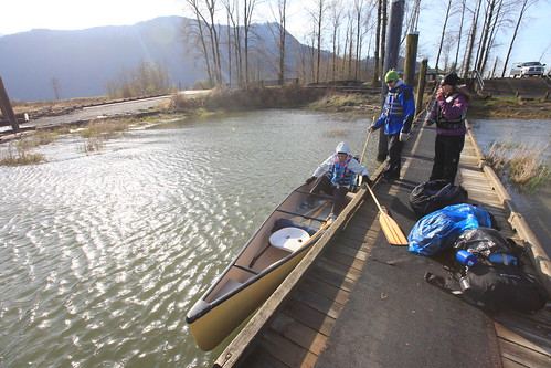
Start by heading north on Rannie Road off Old Dewdney Trunk Road in Pitt Meadows. You’ll end up at Grant Narrows Regional Park. From here, it’s either a long paddle or a boat ride up Pitt Lake. Overnight parking is available for $5. If you’re paddling, double-check that any rental spots are open—this trip isn’t something you want to improvise.
Google Maps Directions:
By Canoe or Kayak
Expect a long day—6 to 8 hours on the water—before the 28 km bike ride even begins. Pitt Lake is shallow and wind-prone, and you’ll want to hug the far right shoreline for the first 8 km. Motorboats are common and their wake isn’t kind to low-profile paddlers.
Here’s a GPS track of canoeing around it. showing the shallow area you have to avoid.
You’ll also need to somehow fit bikes and overnight gear into your boat. It’s awkward, and if conditions aren’t friendly, it can be downright sketchy.
By Motorboat
The quicker, more popular option. A water taxi (if you can find one) will cost around $400 for up to six people. You’ll dock at a busy pier near an active logging site, where you’ll likely run into workers or fishers. From there, the ride begins.
The Ride In
Once you’ve locked up your canoe or disembarked from the boat, it’s time to pedal. The logging road is in surprisingly good shape, mostly flat with a few rolling sections. It takes most riders 2 to 2.5 hours to reach the springs. Small kilometer markers help track your progress.
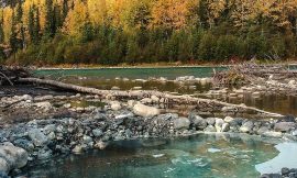
Right after passing the 21 km mark, the road veers left, slopes down toward a bridge, and crosses the Pitt River. That’s your cue—you’re nearly there.
The Final Push
Near the bridge is an informal campsite. It’s a fine spot to pitch a tent for the night. Lock your bike—if it disappears, you’re hiking out 28 km.
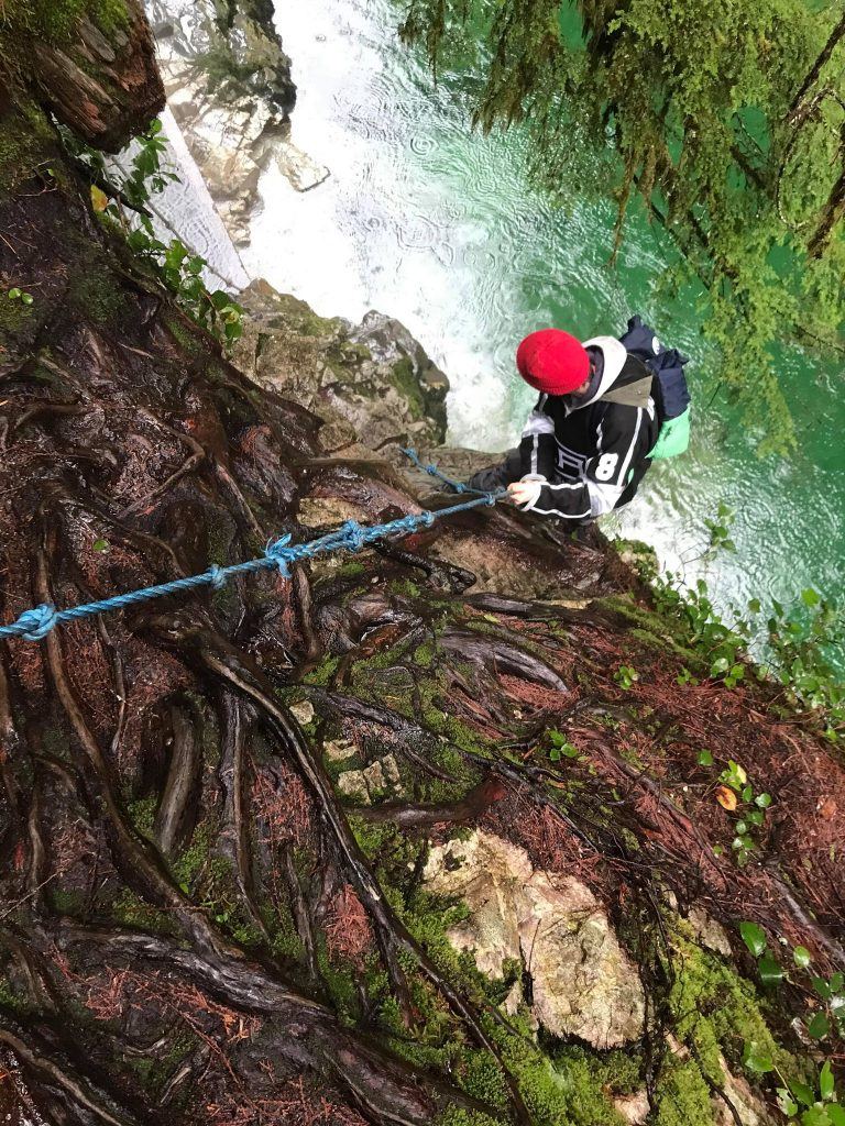
The trail to the springs starts just before the bridge on the north side. Look up into the trees for a small wooden sign. From there, it’s a short 5-minute hike—until it isn’t. The final descent is a vertical 30-foot drop. There’s a thick rope anchored to a tree to help you down. But make no mistake: it’s a rappel. If you slip, you’re not walking away.
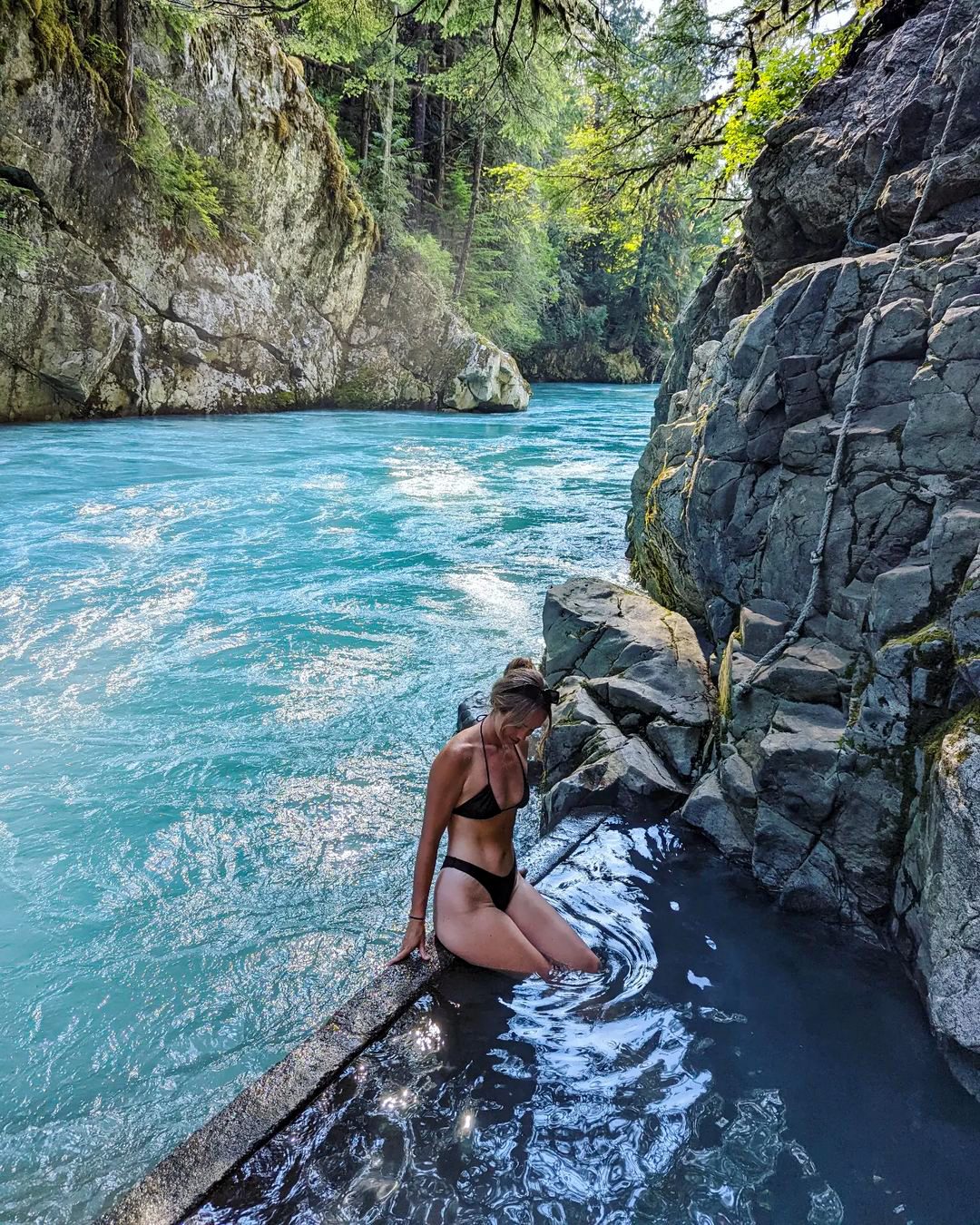
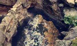
What Awaits Below
Down in the gorge, you’ll find a natural hot spring beside the roaring river. No tubs. No decks. Just rock, water, and wilderness. There’s no cell signal. No help coming. Soak it in—literally—but be smart.
Before You Go
Leave a detailed trip plan with someone. Bring a GPS communicator. Know your limits.
Pitt River Hot Springs isn’t easy. But for those who make it, it’s something you won’t forget.
Featured photo by @caylievalley
Pitt River Hot Springs
6PM
10°
7PM
10°
8PM
10°
9PM
9°
10PM
8°
11PM
7°
☁️ 10° (Feels like 9°)
Overcast Clouds
🌅 Sunrise: 5:35 AM
🌇 Sunset: 8:38 PM
💨 Wind: 1 m/s
📡 Visibility: 10 km
☁️ Cloudiness: 100%
💧 Humidity: 50%
📈 Pressure: 1024 hPa
🔆 UV Index: 0.82
3 Day Outlook
Fri
5° / 12°
Overcast Clouds
Sat
4° / 8°
Rain And Snow
Sun
3° / 8°
Rain And Snow
🕒 Last updated: May 8, 2025 6:24 PM (36 mins ago)


This error message is only visible to WordPress admins
Error: No posts found. No posts made to this hashtag within the last 24 hours. No posts made to this hashtag.
Views:
50,553 views