Thumbs Up or Down
0 liked this post
0 didn't like this post
Brim River Hot Springs: Remote Soaking on BC’s Wild North Coast
A Tidal Hot Spring Deep in the Kitimat Wilderness
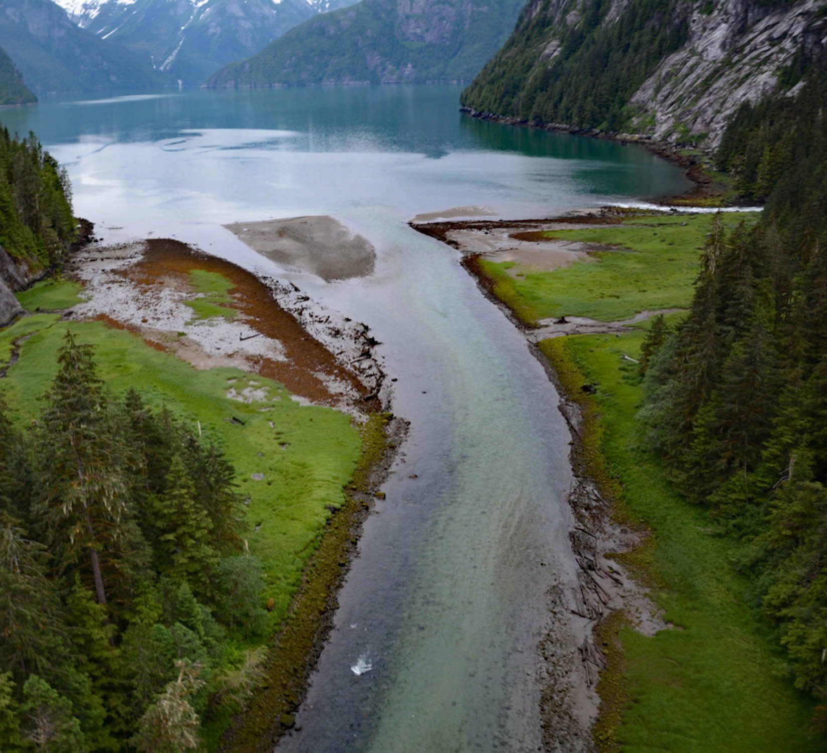
Brim River Hot Springs isn’t for casual road-trippers—it’s a destination for the prepared, the curious, and the kind of adventurer who doesn’t mind planning around the tide. About 600 metres upstream from the mouth of Owyacumish Bay, on the opposite side of Gardner Canal, these hidden springs sit on the east bank of the Brim River, in a region where the landscape still feels untouched.
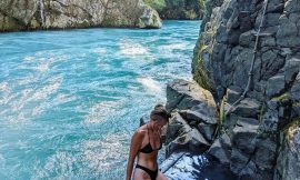
The river here is tidal, and at high tide, it’s possible to paddle a boat right up to the springs—though you may find them partially submerged. At low tide, you’ll need to walk in from the old homestead on the mudflats via a short forest trail. Either way, it’s off-grid, off-map, and all part of the experience.
A Protected Place
In 2005, the area around the springs was officially designated as the Brim River Hot Springs Protected Area, safeguarding about 500 acres of pristine old-growth rainforest, geothermal activity, and wildlife habitat. Just next door, the Owyacumish River Provincial Park covers another 1,989 acres of untouched wilderness. Together, they showcase the incredible natural beauty of BC’s remote north coast.
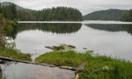
The terrain is dramatic: narrow valleys hemmed in by steep, bare rock walls, waterfalls dropping through thick cedar and spruce forest, and the snowy skyline of the Kitimat Ranges in the background. Wildlife is abundant—from bald eagles and shorebirds to black bears and grizzlies. The whole area is alive, and it feels it.
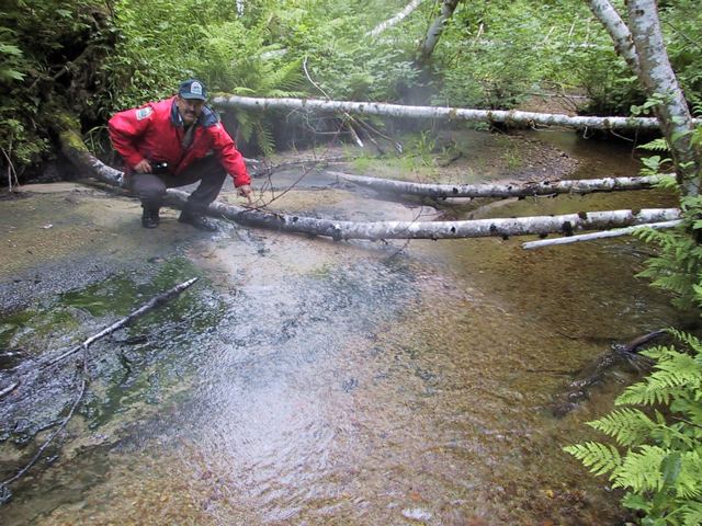
The Springs Themselves
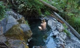
The springs emerge from the east bank of the Brim River and have been recorded as hot as 56°C (133°F). They’re all natural, with no formal development—just the river, the rock, and the warmth. Depending on the tide, they can be fully exposed or underwater, so timing matters. There are no soaking tubs, no signs, and no infrastructure—what you see is what you get.
Indigenous and Historical Significance
In the Haisla language, the Brim River is called Uyagemis, which means “facing west.” Owyacumish Creek nearby is known as Anak’edi. Both waterways lie within the territory traditionally stewarded by the Gwenaxnud, head of the Haisla Blackfish Clan. These are sacred, storied lands, and any visit should be made with respect and understanding.
The English name “Brim River” likely comes from Royal Navy surveys done by Captain Daniel Pender between 1857 and 1870, though its exact origin remains unknown. What’s certain is that this place has been significant to those who’ve traveled and lived here for far longer than the maps suggest.
Planning Your Visit
This is a backcountry trip through and through. Access is by boat via Gardner Canal or floatplane. There are no official trails, no campsites, and no facilities. Bring everything you need and leave no trace.
Tide charts are essential. Wildlife awareness is mandatory. This is coastal wilderness, raw and real—so plan accordingly.
For updated info and conservation regulations, check BC Parks’ pages on the Brim River Hot Springs Protected Area and Owyacumish River Park.
The Payoff
If you’re willing to go the distance and put in the effort, Brim River Hot Springs rewards you with one of BC’s most remote and rugged geothermal soaks. It’s not easy—but that’s the point.
This is one of those rare places where the water’s hot, the air’s wild, and the world feels like it hasn’t changed in a thousand years.
Brim River Hot Springs
11AM
7°
12PM
7°
1PM
7°
2PM
7°
3PM
7°
4PM
7°
☁️ 7° (Feels like 7°)
Overcast Clouds
🌅 Sunrise: 8:31 AM
🌇 Sunset: 4:16 PM
💨 Wind: 1 m/s
📡 Visibility: 0.052 km
☁️ Cloudiness: 100%
💧 Humidity: 100%
📈 Pressure: 1021 hPa
🔆 UV Index: 0.18
3 Day Outlook
Fri
4° / 6°
Rain And Snow
Sat
4° / 5°
Rain And Snow
Sun
4° / 5°
Rain And Snow
🕒 Last updated: December 4, 2025 11:40 AM (126 mins ago)
. The hot springs bubble out of the stream bed gravel at about 56° C.")


Views:
1,019 views